
The Yarra Ranges National Park is home for me. It’s where I grew up and where I spend most of my time when I’m in Australia. I never really appreciated the beauty of where I lived until I started to travel myself. Now I feel pretty lucky to live in such a beautiful place with so many walks to do.
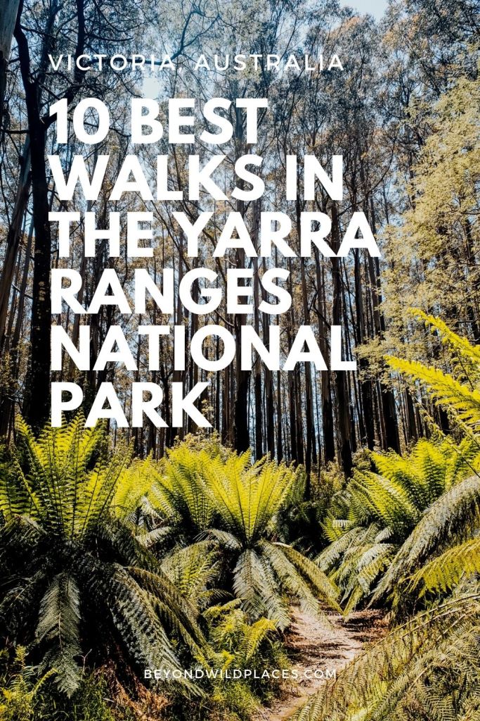
The area is characterised by towering mountain ash trees, lush ferns and plenty of wildlife encounters. It’s one of the most popular places to visit from Melbourne and on sunny weekends, it can get quite busy. From the grassy picnic areas to the stunning forest drives, people come searching for the cool mountain air and beautiful nature.
One of my favourite ways to explore the park is, unsurprisingly, on foot. There’s no shortage of trails in the Yarra Ranges with walks suitable for almost anyone. In this post, I’ve rounded out the 10 best walks in the Yarra Ranges National Park so you can pick from the best of the bunch.
Some of the trails on this list are popular lookouts and challenging hikes such as Mt St Leonard and Mt Donna Buang. However, there’s likely a few on here that you haven’t heard of and that might offer something a little different.
So, if you’re keen to get out on a hike this weekend, here are the best walks in the Yarra Ranges.
Disclaimer: This post contains affiliate links which means I get a commission if you buy a product through my link at no extra cost to you. By doing so, I can keep this blog going and continue to create helpful guides for you. Read more: Privacy Policy
Yarra Ranges National Park: What You Need to Know
The Yarra Ranges National Park is around 80 km northeast of Melbourne. It covers a vast forested area around the three main towns of Healesville, Warburton and Marysville in the Yarra Valley region.
The Yarra Valley is one of the most-visited parts of Victoria for both domestic and international tourists. It makes for a very popular day trip from Melbourne and is especially busy on weekends.
Healesville is considered the heart of the Yarra Valley and is a great base for accessing much of the surrounding national park. There’s currently no tourist information centre in Healesville, but you can find a great one in Marysville or Warburton if you’re after brochures, maps or more up to date information on the trails.
Parts of the park are major catchment areas for water supply. This means that there are roads and sections of the park that are off-limits for public use. You’ll find closed gates and signs indicating which roads are for Melbourne Water use only and penalties do apply.
The towns in the area are serviced by public bus. However, in order to reach the trailheads you’ll need your own vehicle.
The main parts of the park where you can find most of the walking trails are northeast of Healesville around Mount St Leonard, Dom Dom Saddle and Fernshaw, and north of Warburton around Mount Donna Buang. These are the areas that this blog post will predominantly cover.
Looking for walks around Marysville instead? Read: Best Lake Mountain Walks to Do This Summer or Walks and Waterfalls on Lady Talbot Drive
Aboriginal History
The Yarra Ranges National Park is part of the traditional country of the Wurundjeri People. Many of them were displaced from their traditional land and moved to Coranderrk Aboriginal Station which was established in 1863 in Healesville. It became the largest station in Victoria before it was finally closed in 1924. The land around Coranderrk was returned to the Wurundjeri people in the 1990s.
When to Visit
You can visit the Yarra Ranges National Park at any time of the year.
However, in winter you can expect wet and muddy trails and very cold conditions. In the peak of summer, you can expect extremely hot days and a higher chance of meeting a snake or two on the trails. The risk of bushfires is also very real on extreme weather days and you need to be prepared for emergencies.
Autumn and Spring are the ideal times to visit the Yarra Ranges National Park, especially for hiking. However, if you’re well prepared you can visit at any time of the year.
Read next: The Ultimate Day Hike Packing List

Where to Stay
If you’d prefer to stay overnight in the area, most people base themselves in Healesville, Marysville or Warburton. These towns have plenty of accommodation, with B&Bs being the most popular option. There are also a few caravan parks if you prefer to camp or are exploring the area in a campervan.
B&Bs
Brentwood Accommodation | These guys offer both a four-bedroom cottage in Healesville and B&B Apartments just outside of Healesville amongst beautiful gardens. For exploring walks in the Yarra Ranges National Park, the B&B property is most convenient with the walking track to Mt St Leonard running right behind the property. Check the latest availability and prices here.
Healesville Apartments | These beautiful self-contained apartments are ideal for a stay right in the middle of Healesville. You can easily explore the town on foot from this property and most walks in the Yarra Ranges are within a short drive away. Check for availability and the latest prices here.
Caravan Parks and Camping
Big4 Park Lane Holiday Park, Healesville | This caravan park in Healesville has almost every accommodation option available. They have large self-contained cabins and beautiful glamping pods for those looking for a unique stay. If you have your own camping setup, they have both powered and unpowered sites available. Check the prices here.
Marysville Caravan and Holiday Park | If you prefer to stay in the pretty town of Marysville at the northern end of the national park, then this caravan park has plenty of options. Their cabins range from family riverside cottages to smaller double studio cabins. They also have powered and unpowered sites for vans and camping setups. Check prices here.
Warburton Holiday Park | If you want to stay over in Warburton, closer to Mt Donna Buang and the Aqueduct Trail then this caravan park is a nice choice. They have family riverside cabins and superior villas, as well as, powered and unpowered camping sites. Check prices here.
There are no campgrounds inside the actual Yarra Ranges National Park boundary. Although, there are campsites nearby in the Cathedral Ranges State Park, Kinglake National Park, and the state forest around Marysville.

Safety While Walking
The risk of bushfires is severe in the Yarra Ranges National Park. Make sure you check the latest updates on the Vic Emergency website before heading out and try to refrain from walking on extremely hot days.
Snakes are one of the main threats on the trail. They are more common on hot days and you should keep an eye on the ground in front of you as you walk to avoid stepping on any camouflaged tails.
Mobile phone service can be limited in the park area. The major town areas have excellent coverage and you’ll find the higher trails close to the ridgelines and peaks will also have good coverage. Telstra has much better coverage than other providers.
Make sure that you carry enough food and water for your hike. There may be access to some freshwater streams on these trails, but you shouldn’t rely on getting access to any water. You will find drinking taps in Healesville, Yarra Glen, Warburton and Marysville towns to refill if you need.
Most of the trails, picnic areas and carparks are well marked and signposted. There are orange arrows on most trails showing the way as well as bigger signboards at trailheads and major junctions. You should still carry some sort of navigation system, such as a GPS app on your phone or a paper map or guide book. I recommend Maps.Me app for your phone which has all of these trails marked on it.
The estimated walking times on these walks are based on my own experience walking these trails with a little added time to allow for varying levels of fitness. Don’t take these as hard and fast times as it will depend largely on your own fitness and preference for breaks along the way. Try to give yourself plenty of time to complete these hikes.
Responsibility
Do not feed the wildlife. Dogs and pets are not allowed in the national park area.
Leave no trace on the trails and carry all rubbish out with you. There are rubbish bins provided at the main picnic areas and carparks.
Yarra Ranges National Park Map

10 Best Day Walks in Yarra Ranges National Park
Now finally onto the walks in the Yarra Ranges National Park. These are the best hikes you can do in the area from my own experience. Most are medium-hard rating which means you’ll want a decent level of fitness before undertaking them.
Mount St Leonard Circuit
- Start/finish: Donnelly Weir Picnic Area
- Distance: 25km
- Time: 7-8 hours
- Difficulty: Hard
This challenging day hike is one of the best in the Yarra Ranges National Park. The reward of 1300m of total climbing is the view that stretches all the way to Melbourne on a clear day from the top of Mount St Leonard.
From the Donnellys Weir Picnic Area, you need to walk back a bit to find the trail that takes you along the Maroondah Aqueduct to Echo Tunnel. From there you need to head left along Road Seventeen until the junction of Condons Track. You need to take Condons Track, which is an often-overgrown skinny trail that climbs steeply through the bush. You’ll eventually emerge at Monda Road which is a fire trail that heads up to the top of Mount St Leonard.
You’ll pass by signposts indicating Tanglefoot Loop, which is the next hike on this list. Then, you’ll see the final climb that leaves Monda Road and heads up to the fire tower at the top of the peak. There is a public viewing platform which offers panoramic views extending all the way to Melbourne’s skyscrapers on a clear day.
The descent from the mountain follows Road Eleven, a wide dirt road, for much of the way through the forest. You’ll eventually come down to the picnic and car park area of Donnellys Weir.

Tanglefoot Track and Myrtle Gully Loop
- Start/finish: Tanglefoot Picnic Area and Carpark
- Distance: 16.5km
- Time: 5 hours
- Difficulty: Medium
This is a beautiful loop off Monda Road near Mt St Leonard through dense forest. It combines both the Tanglefoot Loop and Myrtle Gully Circuit into a lengthy day hike. You can technically begin this walk from multiple different carparks, with access to Tanglefoot Carpark, Wirrawilla Carpark and Monda Track Carpark along the trail.
Most people begin from Tanglefoot Picnic Area and Carpark. From here you can follow the Myrtle Gully Circuit to begin with. You need to stick to the left trail at both junctions which are 100m apart from each other at the start of the circuit. You’ll find the signpost for the Tanglefoot Track here as it takes you through tall mountain ash and over boardwalks and short bridges.
Once you reach Monda Road, you have the choice of extending the walk up to the top of Mt St Leonard which is just another 1.7km to your left. Otherwise, take Quarry Road that turns right off Monda Road and takes you down to Sylvia Creek. You’ll eventually meet up with the Wirrawilla Walk before continuing back on the Myrtle Gully Circuit to Tanglefoot Carpark.
You can shorten this walk by just tackling the 11km Tanglefoot Loop from the Wirrawilla Rainforest Walk Carpark, without the addition of the Myrtle Gully Circuit.

Mount Juliet Walking Track
- Start/finish: Mount Juliet Carpark
- Distance: 9km
- Time: 3.5 hours
- Difficulty: Hard
Mount Juliet is not for the unfit and inexperienced. This peak is one of the highest in the Yarra Ranges and is a very steep walking track that has over 900m over total climbing in a short few kilometres. For all the hard work on this hike, you won’t be rewarded with any views, which is a little disappointing, but it’s a good walk for anyone looking for a killer climb.
The hike is a little discreet with no official carpark and just enough room for a few cars to park near the gate entrance off Maroondah Highway. Once you walk past the gate, you’ll follow Road Three for a while until you reach a junction. You need to continue straight ahead along the walking track up to the summit.
The summit is marked with a stone cairn. Return the same way back down.
The walking track after the junction becomes quite skinny and sometimes overgrown. It can also be in terrible condition after rain or bad weather, but you’ll find orange arrows showing the way.
Mount Dom Dom Loop
- Start/finish: Dom Dom Saddle Picnic Area
- Distance: 9km
- Time: 2.5 hours
- Difficulty: Medium
This loop walk follows a rough 4×4 track around Mt Dom Dom from the Dom Dom Saddle Picnic Area. It’s not the best walk in the area but for the short distance, you can enjoy the mountain ash trees and have the chance to see some wildlife.
It’s not very challenging with a mostly undulating track and just a short climb at the end.

Monda Track
- Start/finish: Dom Dom Saddle Picnic Area
- Distance: 18km
- Time: 5 hours
- Difficulty: Hard
This is a great day hike in the Black Range State Forest. It’s mostly along wide dirt track through tall mountain ash forest.
At the far end of the carpark, you need to take Dom Dom Creek Road. Follow this for a short while until you reach the track on the left known as Hermitage Walking Track. This track leads you to Maroondah Highway and you need to carefully walk along the edge of the highway for half a kilometre until you reach the Black Spur Caravan Park.
From there, you can cross over the highway and head up Rouch Road. Climb this steep road all the way until an intersection with Nursery Spur Track. Turn left here and then you’ll reach Monda Track not long after. Turn left onto Monda Track and follow it all the way back to the picnic area.
Although you don’t get much of a panoramic view anywhere on this trail, the forest here is incredibly beautiful and lush. It’s a great hike that is not as popular as others on this list.

Morleys Track
- Start/finish: From Dom Dom Saddle to Fernshaw Picnic Area
- Distance: 9.5km
- Time: 2.5 hours
- Difficulty: Medium
Morleys Track is a one-way trail that takes you from Dom Dom Saddle to Fernshaw Picnic Area on the Black Spur. It can be a little overgrown, with little track maintenance done in this area, but there are visible tree markers showing the way through the mountain ash forest.
You can complete this in either direction with a car shuffle, although it’s much easier from Dom Dom Saddle down to Fernshaw than the other way. If you decide to return the same way to make it a full day hike of nearly 20km, expect a long hill climb back up to Dom Dom Saddle (this would be considered hard on the difficulty scale too).
Note: I’ve been alerted to the fact that there are some large trees obstructing this track at the moment (early 2021), so be aware of potential navigation issues in some places.

Mount Donna Buang via Mount Victoria
- Start/finish: Martyr Road, Warburton
- Distance: 15km
- Time: 5.5 hours
- Difficulty: Hard
This is one of the two standout walks in the Yarra Ranges National Park along with Mt St Leonard. With a total climbing of 1100m, it’s a steep and rewarding hike with spectacular views from the tower on Mt Donna Buang. Although many people opt to drive up the mountain, this hike makes you appreciate this part of the park even more.
The trail starts from the end of Martyr Rd in Warburton. It starts gentle enough until you cross over the O’Shannassy Aqueduct Trail to start climbing steeply towards the top. The trail is skinny in sections and feels relentlessly steep through the forest.
You’ll cross over the paved Donna Buang Road and then continue on a well-defined track up to Mt Victoria. It becomes much gentler after this, as you continue along to Mt Donna Buang. Climb the tower at the summit for the incredible view over the entire Yarra Valley and even Melbourne on a clear day.
Start returning the same way back, but this time turn right down a track that takes you via 10 Mile to Donna Buang Road. Follow the paved road for a short distance until you reach the Mt Victoria Walking Track intersection. Turn right down the steep trail again and walk back to your car.
A stop in a cafe in Warburton after this tough walk is obligatory!
Note: In winter, snowfall is common on Mt Donna Buang which means the trail may be closed or difficult to tackle.

O’Shannassy Aquaduct Trail
- Start/finish: Parrot Rd off McMahons Road to Track 18 off O’Shannassy Road
- Distance: 34km
- Time: 7-8 hours
- Difficulty: Easy-Medium
This long trail follows the O’Shannassy Aqueduct from Don Valley to East Warburton through the Yarra Ranges National Park. The entire length of the trail is just over 30km. It’s usually broken into sections or used for short day use from various access points. We broke the trail into half and tackled it that way; it really comes down to how much you want to do in a day.
It’s a very pretty walk through tall trees and lush ferns. It’s common to see plenty of native wildlife too.
Although much of the trail is relatively flat as it follows the aqueduct, there are a few short and steep hills when it comes to accessing the trail from some carparks and when it crosses roads.
The most accessible parts of the trail and most popular carparks are at Dee Road in Millgroveand Yuonga Road in Warburton.
Read next: Local’s Guide to Warburton in the Yarra Valley

McMahons Creek Goldfields
- Start/finish: Little Peninsula Tunnel, Woods Point Road
- Distance: 10km
- Time: 3.5 hours
- Difficulty: Medium
It’s best not to attempt this walk in winter or after heavy rain or storms as the trail can be closed due to damage (as we discovered when we drove there in the middle of winter to do it!). Otherwise, this is definitely one of the lesser-known trails on this list.
It’s located just past Warburton on Woods Point Road and begins at Little Peninsula Tunnel. Alternatively, you can also begin at Big Peninsula Tunnel which is just 1km further along the road. Both spots have carparks.
The trail takes you through the forest surrounding the Yarra River and past evidence of the former goldfield in the area. The loop is marked but there is little maintenance done on the track and sections can be closed for some time. Make sure you stay on the trail and don’t explore any of the old mineshafts that you pass.
There are generally sign posts at the carparks which outline track closures or damages so make sure that you read these before setting out.

Mount Riddell
- Start/finish: Mt Riddell Road, Healesville
- Distance: 12km
- Time: 3 hours
- Difficulty: Medium-Hard
This has kind-of been a hidden secret in Healesville until recently. My mum will not be impressed that I’m including it on this list, but more and more people are discovering this great walk in the Yarra Ranges.
The wide track meanders all the way from the bottom to the top of Mt Riddell in Healesville. Over the course of 6km, you gain 600m of elevation with a relentless climb that is perfect for some hill training (I used it to train for the Larapinta Trail).
Once you reach the top, you’ll find a picnic table. From there, you can walk another few hundred metres to the official cairn, although there’s no actual view.
You’ll find the best views are on the way up. There are two spots in particular that are slightly cleared enough so you can see across to Maroondah Dam and Mt St Leonard.
You need to return the same way, with the other tracks all being closed for Melbourne Water use only.

Picnic Areas and Car Parks
Donnellys Weir Picnic Area
This carpark and picnic area is near the popular Maroondah Dam Reservoir Park in Healesville. It marks the official trailhead of the Bicentennial National Trail that runs all the way up to Cooktown in Queensland. It’s also the starting point for hiking up to Mt St Leonard.
There is a picnic shelter, BBQ area and toilet block. For a more picturesque setting for a picnic, the Maroondah Dam Reservoir Park nearby is a nice spot.
Fernshaw Picnic Area
This picnic area is in the middle of the Black Spur Drive. There are BBQ facilities, picnic shelters and toilets. It’s connected to Dom Dom Saddle Picnic Area by Morleys Track.
Dom Dom Saddle Picnic Area
Towards the top of the Black Spur Drive, this is a popular picnic area and carpark in the Yarra Ranges. There are toilets and plenty of clear open spaces for a picnic. A number of hiking trails start at this picnic area.
Badger Weir Picnic Area
Although this is not connected to any of the walks mentioned on this list, this picnic area is a nice place to go for a picnic in Healesville. There are some short, gentle trails here too if you’re after some easier walking options.
You’ll find parking, BBQ facilities and toilets here.
Essential Hiking Gear
Nearby Hiking Destinations
- Best Walks and Waterfalls in Kinglake National Park
- Guide to Hiking in the Cathedral Ranges
- Best Lake Mountain Walks to Do in Summer
Pin this post


Just a small heads up, assistance dogs are allowed and are welcome in the Yara Ranges.
[…] and resort area melt to reveal walks through snow gum woodland with stunning views across the Yarra Ranges National Park and lower Victorian Alps. While it’s also become a mountain biking destination in recent […]
[…] Just down the road from where I grew up, Warburton is one of the prettiest towns in the Yarra Valley. Surrounded by towering mountain ash trees and rolling hills, the laidback town is a wonderful place to visit for a weekend from Melbourne. I’ve been wanting to put together a guide to Warburton for a while, to allow more people to see some of the best of the Yarra Ranges National Park. […]
[…] some of the densest rainforest I’ve explored in Victoria, and while it has similarities to the Yarra Ranges National Park or the Otways, it feels much more ageless and […]
[…] 10 Best Walks in the Yarra Ranges National Park […]
[…] 10 Best Walks in the Yarra Ranges National Park […]
[…] 10 Best Hikes in Yarra Ranges National Park […]